The River Cober has flooded the town of Helston, Cornwall, for centuries having social, economic and ecological consequences. Ella Rosser’s Masters (Camborne School of Mines) dissertation explored the role of the upper catchment as a contribution to flooding in the lower catchment.
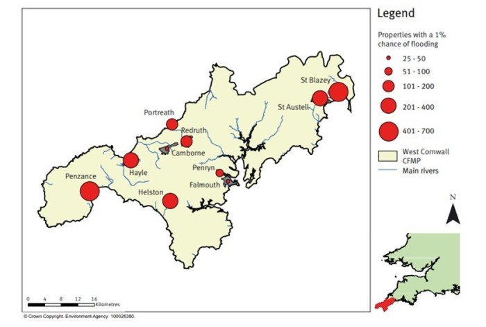
Taking into account current flood defences, a map showing the risk to properties in a 1% annual probability river flood (Environment Agency 2012)
Sub-basins in the watershed were mapped using LiDAR data to delineate drainage areas that may need mitigation to reduce the concentration of drainage, in turn reducing flooding downstream. The Rolling Ball model was utilised, to map the surface flow over land and into the river.
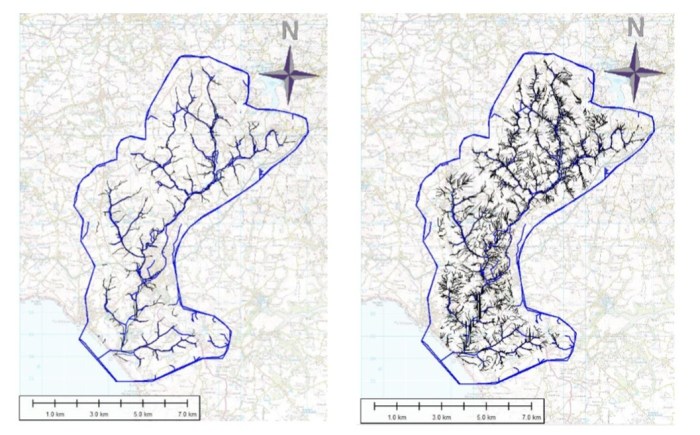
Rolling Ball at 50,000 m (left) and at at 5,000 m (right)
A geochemical survey, consisting of 126 soil samples showed that abandoned mine sites still show elevated concentration of heavy metal pollutants close to the sites, with the highest value for arsenic found at 843 parts per million (ppm), lead 2669 ppm, tungsten 338 ppm, copper 2241 ppm, tin 14,429 ppm and iron 20,7060 ppm.
A discussion on the toxic effects to organisms and humans from these concentrations of pollutants, lead to exploring the mitigation measures against pollutants in the soil from abandoned mines and linking this mitigation with the flood attenuation measures upstream.
You can read the full dissertation here: 2017 – An investigation into mine pollutants and drainage mapping in the upper Cober Catchment, Cornwall.


